In 2005, it was in this more-than-this-out of the way place where I began bicycling the Nez Perce National Historic Trail. A journey that took me through Oregon, Idaho, Wyoming and the Nez Perce’s finale in the Bear Paw Mountains of Montana. This Native American history lesson covered 1,900 road miles. Back then, I was a cycling fanatic instead of a hiking, IPA drinking fanatic. (In another era I pedaled over 100,000 miles in a ten year span).
The Nez Perce story is a sad one. It’s about an inspiring Leader (Chief Joseph), broken treaties, chase scenes, multiple battles, death and capitulation in the low lying wind swept Bear Paw Mountains. In August, 1877, the Nez Perce were captured just short of their Promised Land. Canada.

To this day, that ride was one of the most interesting and exciting adventures I ever completed.
Of course, I wrote a story about it. For $3.00 you can purchase the complete work on Kindle.
Here’s the link:
https://www.amazon.com/Wandering-Jew-Pursues-Nee-Me-Poo-ebook/dp/B007HQXI86
Joseph, OR is the official National Park Service starting line of the Nez Perce Historic Trail. Thirteen years ago, I took a rest day here to take in all things Nez Perce related and to get a glimpse of the nearby Eagle Cap Wilderness. I ambled up Wallowa Trail wearing uncomfortable bicycle touring shoes. I saw lots of mountains. They were teasing me to take a closer look. I knew I’d return one day.
I arrived just prior to the long Labor Day weekend. Bad timing on my part.

I was fortunate to score a campsite in an RV Park owned by a few Stoners. (Not that there’s anything wrong with that, but is it asking too much for them to empty the garbage cans or clean the bathrooms?) I was told I could stay for a few nights, but had to leave on Saturday and Sunday. They were booked up.
This provided me with an excuse to load my backpack and head uphill. But first, I needed some locals hiking advice. I purchased a Eagle Cap Wilderness map to bring with me to the US Forest Service office. It was a busy place. I wasn’t the only hiker in remote Northeast Oregon. I waited my turn.

After a smile and a cheery “Good Morning!” I got down to the point, (there was a queue forming behind me), “What area will I find the highest concentration of Alpine scenery?” This wasn’t the first time she heard this question, “Lake Basin. But with the Labor Day Weekend, it’ll be crowded. The Eagle Cap Wilderness has been discovered.”
Indeed it had been. Early on the Saturday of the Long Weekend, I drove to the end of the Wallowa Road. The official trailhead parking lot was full. I found a pull off on the side of the road about a quarter mile away. Now my challenge would be scoring a campsite. Off I went at a highly caffeinated clip. My goal was Horseshoe Lake about nine miles away. I passed many hikers with the same idea in mind.
The first six miles of the hike is in the Wallowa River Canyon. A steep sided place where the summer sun is seldom seen. The hike wasn’t all that interesting among the trees with mere glimpses of the river. At Six Mile Meadow I turned hard right and plunged across the waterway. From that point, I had three miles of uphill along a series gentle switchbacks. As usual, the views improved exponentially.

When I made Hourglass Lake, I crossed over a logjam to a tiny peninsula. I looked left, right, behind and in front of me. No tents! For two nights, I would occupy (without bad intentions) a Federal piece of lakeside property. Perfect. It was noon. I spent the rest of the day, watching potential squatters hike by and trout rising up for flies. A great start for my weekend.
I woke to a mirror glass reflection of nearby Hurricane Ridge. After eating a humble breakfast washed down with two Starbucks shots, I packed for the day. My goal was the namesake of the Wilderness: 9,573’ Eagle Cap Peak. A nearly 14 mile round trip hike.

I strolled by a series of Lakes: Lee, Douglas, Moccasin and Mirror. The closer I got to Mirror Lake the higher the concentration of tents and backpackers there were. It was getting on to RV Park packed. That’s a lot of people in a small area. (At Hourglass, I had three neighbors spread out over a half mile. Not bad.)
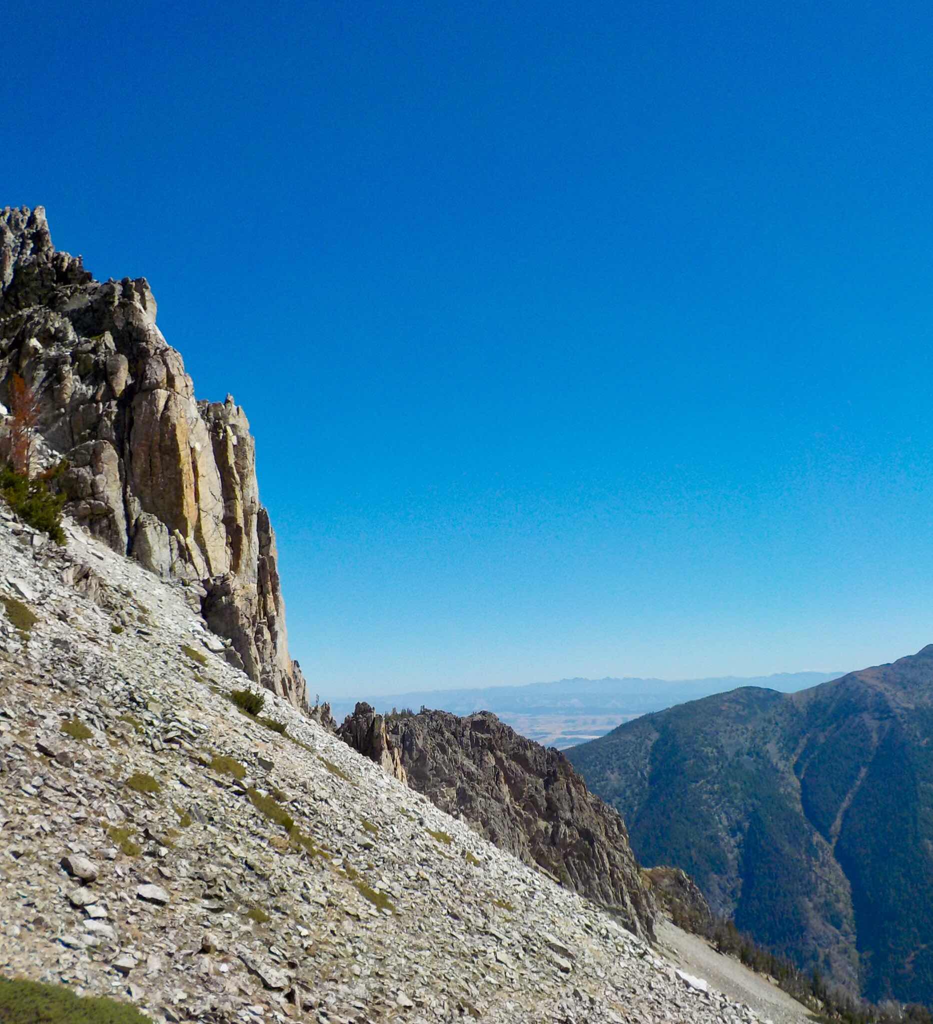
The flat summit of Eagle Cap was a small mob scene with a few snarling dogs. I snuck off to a scenic side for a bit of quiet. The Wallowa Mountains aren’t the punk spiky prominences one might find in the Sawtooths of Idaho, or the Wind River Range of Wyoming or the Sierra Nevada’s of California. Most seem rounded and approachable. From my vantage point, they looked user friendly and somewhat bucolic, although getting to them would require plenty of sweat labor. Remember those steep sided glacier created canyons. All in all, I gave the Wilderness two-thumbs up. It’s a beauty.

Now I’ll attempt to make a point: Eagle Cap Wilderness is not easy to get to. The main trailhead is literally at the end of a long, thin, twisty two lane road. There are no population centers nearby. The closest is Boise (over 2.5 hours away). The furthest is Seattle (more than 5 plus hours away). Yet people come. Many Americans and Passport bearing visitors lust for Wilderness. They will spend time, energy and money in their efforts to visit these special places. This is the BIGLIEST reason why removing acreage from preservation/conservation status (IE: Grand Staircase/Escalante and Bear Ears National Monuments) is short sighted and just plain STUPID.

This is what I’m learning about Public Land. Create/Protect or Preserve it and People will come. Oh Yes! People will come. Saving Wild Lands for present and future generations is BIGLY smart and the right thing to do.
Read more about this concept.
Chief Joseph and the Nimíipuu would approve of this message.
Still waiting for an overpriced new engine for Barley the Van in Chelan, WA.
Jeff
Thanks for the gorgeous pictures! I'm very sorry about Barley needing an engine transplant!
ReplyDelete