Wednesday, August 3, 2016

"Invalids Need Not Apply"

This very un-PC statement (almost Trump-like) was part of the Help Wanted ad the U.S. Forest Service posted in their infant days as a Federal Land Baron. (The USFS was established in 1905). The notice went on for its requirements for perspective Forest Rangers. A Ranger must be able to: "built trails and cabins; ride all day and all night; pack, shoot, and fight fire without losing his head." 

What! No mention of creating a frothy cappuccino? 

As you can see, the USFS was asking a lot of mere mortals. In 1908, the Coeur d'Alene National Forest hired Edward C. Pulaski. The fledgling organization then scored all they had asked for and a whole lot more. Ranger Pulaski was the right man at the right time in "The Big Blowup" or AKA "The Big Burn" of 1910. 

In the summer of 1910, the Forests of northeast Washington, the Pan Handle of Idaho and western Montana were "snap, crackle, pop" dry. There wasn't a can of beer's worth of rain in the month of July. Small scattered fires began to spring up. They were fought by small and scattered fire fighting crews. There wasn't any cohesive game plan or organization to their efforts. At the time, Big Picture communications and an Incident Command System were nonexistent. 

On August 20th, there was a change in the weather. A cold front had entered the scene. It was accompanied by a wild land firefighters worst nightmare. Wind. Just like that, those isolated pockets of fire coalesced into something terrible. Imagine a bowl of Coleman fuel with an addition of a lit match Whump! 
 
That faithful morning, Pulaski left the mining town of Wallace, Idaho. His parting words to his wife and adopted daughter were "Good bye I may never see you again." Now, that's a John Wayne moment! He then went up into the steep hills and became part of firefighting history. 

As Pulaski ascended toward the flames, he noticed rapidly deteriorating conditions. He gathered 45 firefighters and shepherded them into an abandoned mine tunnel. He placed a wet blanket across the entrance. A few of the panicked men tried to flee the tight enclosure. Ed pulled out a pistol, and threatened to shoot the first one to make a move. No one called him on it. The heat/smoke/CO2 eventually caused all to lose consciousness. Five never woke up. 

In the inferno's aftermath, the survivors stumbled through the ashy chaos and back into the half-burned over town of Wallace. Pulaski spent the next two months in the hospital recuperating. The Big Burn left him damaged both physically and mentally. He died one year after retiring  from the USFS in 1931. 

His legacy continues. Ed left behind a wild land firefighting tool that bears his name. The Pulaski-half ax and half mattock. He came up with the idea in 1911 and fine tuned it by 1913. 

78 firefighters were killed in the Great Fire of 1910. The conflagration consumed  3,000,000 acres of timber too. (Cinders were free falling from the darkened skies as far away as Denver and Chicago) 

Now we ask this question? With all the improvements in training, communications and weather forecasts; why do wild land firefighters still die? 


Be safe out there.
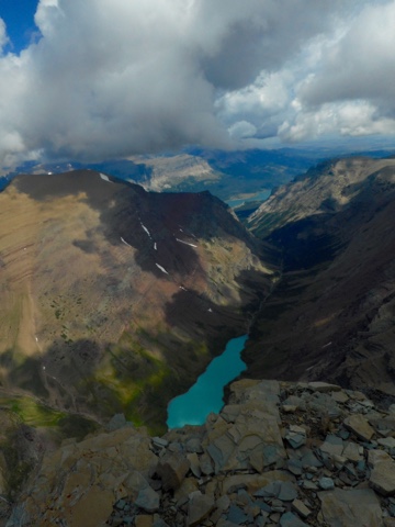
If you find yourself in Wallace, Idaho please take the time to hike the Pulaski's Tunnel Trail. It's a fitting tribute to a true American Hero. 

Jeff

The final photo is for Ed.


Saturday, July 30, 2016

A Montanan Montage...

The tourist slogan for Montana once was "It's Time".  A cerebral concept that makes a thoughtful person ponder. Time for what? Well, to see the incredibleness of the "Big Sky" State! Or in my case, to try and squeeze in as much as I could in two weeks. 

There's a lot to see here.

Montana is the fourth largest state in the Union. There's 147,000 square miles to roam around in. Although I wouldn't mosey onto private property. (Montanans are a well-armed mob. Think Unabomber) 

That's OK. There's still plenty of Federally owned National Parks, Wilderness Areas and Forest Service land to venture upon. 

And that's what this Wandering, Wondering Jew did. I guesstimated I covered over 130 ground miles in search of "Ooos and Ahhh" views. That's my new career. I hike to pretty places. 

See for yourself. 

Many of these pix were shot in Glacier National Park.
In 1910,  Glacier was deemed worthy of National Park status. At the time there were 125 active glaciers. Now, there's  25. The NPS scientists believe those icy holdouts will be history by 2030. The usually conservative National Park Service uses the term "climate change" to explain this phenomenon. For an organization who tries not to step on anyone's toes, this says heaps. 

The Montanan tourism slogan is spot on. It's time. 

Fun MT factoid: There are almost as many elk, antelope and deer per square mile in Montana as there are two-legged animals. (6.1 vs. 6.8). There is no mention if it's OK for those wild hay burners to trespass upon private property. 

So many places to see, so little time.

Cheers,
Jeff


Wednesday, July 27, 2016

In the Summer of 2005...

I took off in hot pursuit of the Nimiipuu Tribe. For us White Folks they are better known as the Nez Perce Indians. I was touring on a bicycle tricked out with four panniers and a duffle bag. That's all I carried for two months and thousands of miles. See? I was into Minimalism before it was cool. 


http://jeffsambur.blogspot.com/2016/06/i-never-thought-of-myself-as-a.html

Now about the Nez Perce and what makes them so special: 

The year was 1877 when 750 Nez Perce tribal members and 2,000 ponies left their ancestral homelands for a better future. That's what they had hoped for. They didn't want to be subjugated to a non-nomadic reservation lifestyle. 
Sound familiar?


The Nez Perce's empire once spanned a four state region of what is now Washington, Oregon, Idaho and Montana. Their territory included large swaths of forests, valleys, plains, canyons and a few notable rivers complete with salmon runs. It was a large piece of Paradise on Earth. After all the shredded treaties, their Real Estate shrunk by 90%. The U.S. Government brokered a ruthless deal. Move to the Reservation or be forced upon it by the Cavalry.  

A few of the clans said in essence, "Screw that!" They became known as the "Non-Treaty Nez Perce." Once again, a group of Native Americans were led by a charismatic leader. His name was Chief Joseph. The bands decided to take their chances on the road. Their immediate goal was to peacefully get away from the U.S. Army. Their long term goal was to join forces with their Allies, The Crow Tribe on the eastern side of the Rockies. In the end, neither plan materialized. 

What followed was a retreat featuring twenty skirmishes and battles. It was a circuitous route of over 1,100 miles designed to keep the Cavalry at bay, avoid White settlements and stay out of range of their Old Time Indian enemies.

They were eventually headed off at the pass by Colonel Nelson Miles in the Bear Paw Mountains of Montana. They were captured a mere 40 miles from the sanctuary of Canada. 

In 1986, the National Park Service commemorated their escape route. It's appropriately  named the Nez Perce Historic Trail. In 2005, I flew into Spokane, Washington reassembled my touring bike at the airport and began my journey of discovery. 

While the Nez Perce were attempting to find freedom, I felt crazy-free while following along on my bicycle. At the time, I doubted if their was a happier dude on the planet.

Now I don't ride much since my sedan/bicycle accident. 

http://jeffsambur.blogspot.com/2016/07/five-years-ago.html

BTW: I wrote an article about my flight as well.

https://www.amazon.com/Wandering-Jew-Pursues-Nee-Me-Poo-ebook/dp/B007HQXI86/ref=sr_1_6?ie=UTF8&qid=1469460124&sr=8-6&keywords=Jeff+Sambur

However, I'm pleased to report, I still feel incredibly free and very happy.
I'm now using horsepower to get around instead of pedal power.

The photos are from my recent visit to the Big Hole National Battlefield near Wisdom, Montana. Many Nez Perce women, children and Warriors were slaughtered in a surprise attack by the U.S. Cavalry and numerous local volunteers. A successful counter-attack saved the day for the remaining tribe members. Their retreat continued. 

"I still haven't found what I'm looking for."
U-2 lyrics

From Glacier National Park,
Jeff


Thursday, July 21, 2016

It's Bigger than Rhode Island!

Well, so are some Super Walmarts. 

So how big is big? The Absaroka Beartooth Wilderness  can't be bothered to reside in one state. The big chunk lives in Montana. There's a slop-over portion in Wyoming. It takes three National Forests to contain it. In the big picture, it's part of the Greater Yellowstone Ecosystem. 

This wild expanse is made up of two distinct mountain ranges. 

The Beartooths are granite based, and occupy an above tree line topography. (That's more my style!) There's not much wild life since animals can't digest rocks. 

The Absaroka's are volcanic in nature. There's lots of trees (except for where I hiked today!) They are home to heaps of mammals, including Ursus horribilis. Better known as the Grizzly Bear. I am scared poopless of animals capable of making me a kosher appetizer.

I hiked two trails in the Absaroka's. They couldn't have been any different. 

My first hike was up to Pine Creek Lake. The payoff was worth the 3,500" of uphill in the five miles to get there. No complaints here. (See the photos). 

My second hike was along the South Fork of Deep Creek up to Davis Pass. There were no trees. In 2012, a careless human started a fire on private property which spread into the National Forest. The blaze incinerated an entire four-mile long valley of mature timber. There were no survivors. Instead of stands of lodgepole pine, spruce and fir, there's stands of fireweed. There's also berries, common Mullen and runty aspens, red maples and miniature lodgepoles. 

It's sad. 

All this devastation caused by one human pyro accident. I'm OK with lightning caused fires. That's Mother Nature, but I get upset over stupidity.

Don't hike the South Fork of Deep Creek for another 100 years. 
Smokey Bear is right. "Only you can prevent wildfires." 

Don't play with matches.
Jeff


Wednesday, July 20, 2016

It's said History is written by...

the winners.  

At the Little Bighorn Battlefield, there were no winners. 

The battle took place in June, 1876. This deadly struggle was the culmination of broken treaties, the uncompromising advance of Manifest Destiny, the clash of cultures who shared no common traits (other than being humans) and a few charismatic leaders. 

The White Folks were led by George Armstrong Custer. He was a Civil War General who led his troops from the front. He was fearless. He had eleven horses shot out from under him. He made great copy for the press. He might have been reckless and lucky. He was totally clueless on battling Indians who didn't follow standard military procedures. 

The Lakota,  Cheyenne and Arapaho were led by Chief Sitting Bull. He was more of a spiritual leader than an X's and O's military strategist. He called the Reservation Indians fools and suck-ups. He exhorted them to join him and his followers and return to their tried and true way of life. Many did just that. When you think about it, the Indians just wanted to be free to live their nomadic lifestyle. I can relate to that. 

Let the battle begin!

Custer's Crow and Arikara Indian scouts spot a large Lakota/Cheyenne/Arapaho  encampment on the banks of the Little Bighorn River. Custer didn't want this prize to escape. He divides his command. A tactic used often in the Civil War by General Lee. 

Major Reno led a surprise attack on the sleepy campers. When the Warriors woke up, Boy! Were they mad! The Braves rallied and chased Reno and his broke down command back across the river. The retreat was anything but orderly. Forty soldiers died trying to make it to higher ground. Captain Benteen's battalion joins Reno on the ridge top. They dig in with a siege mentality mindset. The soldiers hold on for a day and a half.

Custer and his battalion move north along the bluffs to get in front of the encampment.  About this time, the fog of war rears its ugly snout. Custer has lost contact with his beleaguered battalions. He and his 225 Cavalrymen were virtually on their own. No historian knows the moment when Custer realizes that the attackers were now being attacked. Many of his soldiers panic and try to escape the trap. They are cut down. About 41 horsemen and Custer make it to Last Stand Hill. There, they shoot their steeds to serve as breastworks. For a cavalryman, this is the final act of capitulation. The one sided onslaught is over in about thirty minutes. 

Now, all is quiet on this deceptively steep battlefield. White markers indicate the approximate points where the soldiers met their unexpected demise. Red/brown markers indicate where the Native Americans fell defending their way of live. 

The victory was a short lived one. The combatants would eventually end up on Reservations. 

Sitting Bull would die at the hands of his own people in 1890 on the Standing Rock Reservation in South Dakota.

It's a place worth seeing and pondering over.

From the banks of the Yellowstone River near Livingston, Montana.
G' day!
Jeff


Tuesday, July 19, 2016

Forty-one years ago...

I walked into Diamond J Bar in Lovell, Wyoming, and made my way through the cigarette smoke, country music and cowboy hats to the main bar. 

I leaned toward the bartender and asked, "KenIhaveapitcherofCoors."

He looked at me funny. 

I had made my request in a rapid-heavy-handed Bronx accent. I might as well have been speaking Swahili. What we had here was a complete failure to communicate.

I tried this approach, "Can-I-have-a-pitcher-of-Coors? Please?"

"Hell! Why didn't you say so in the first place!" 

Well, I sort of did. This was my first realization that things were different in the West.  
I learned from this experience. I needed to speak Western States English. I had to change. The West was where I knew I wanted to be. 

Back to the point of the story:

The next morning, I began my first seasonal gig with the U.S. Forest Service in the Bighorn Mountains of north-central Wyoming. I was assigned to a tree marking crew. This meant we painted many cords of Engelman spruce trees in preparation for a timber sale. The unfortunate ones were painted orange. They would eventually fall to a loggers chainsaw. We were called "Timber Beasts" by our cohorts who had jobs less stressful to the forest than creating small clear cuts. I envied them. My job wasn't fun other than the times we got to spray paint a cow who wandered within our range. 

When the weekend came about, stumbling through the woods was the last thing I wished to do. I was then 21 years old, brimming with testosterone and energy. The bright lights, big city of Sheridan or Story or Lovell or Buffalo, Wyoming beckoned. I visited bars, drank beer and looked at pretty cowgirls. (I still like going to bars and looking at pretty women. Somethings never change.) 

In retrospect, I never got the chance to notice the beauty that was all around me. I was in the freaking work mode. I'm now making amends. I spent over a week and many trail miles in the Cloud Peak Wilderness. It is indeed an amazing place. 

See for yourself. 

BTW: In a round about way, my first gig as a Bighorny led to my eventual career as a firefighter. 


Yes, the West is still the best part of America. In the next few months, I'll prove this with words and photos.

From Garryowens, Montana
Cheers!
Jeff

PS. In case you missed my first post from Cloud Peak.


PPS.
Thank You,  LBJ for signing the Wilderness Act of 1964


Thursday, July 14, 2016

It's a bad sign...

when you wake up and see your tent resembling an igloo. 

My plan for the Cloud Peak Wilderness was to hike to the top of its namesake. Easy enough right? The Weather Channel promised me nothing but skin cancer causing sun. In other words great conditions for summiting the 13,166" mountain. 

I went to sleep the night before my hike with no weather concerns. Then I heard the gentle drip, drip, drip sound of Wet Death. It was followed by a Ginger Baker drum solo beating down on my rip stop nylon. Hmmm.  If there's a cold rain at 10,100" then it must be White Death above me. 

Sure enough, from my lower vantage point the mountain was looking like a Ku Klux Klan gathering. One big white cap. I took the Polly Anna approach. Maybe by the time I summited, the snow will be melted off. Good idea except there was more gray matter in the sky than blue matter. It wasn't warm either. 

Cloud Peak is comprised of angular granite boulders ranging in size from toasters to refrigerators. None of the stones reside on a level plain. Add slick White Death and ice to the blend and it makes for a dangerous rock hopping experience. I split my shins a few times when I landed wrong. At least this time, there was no spurting blood. 

I persevered to within 100" of the summit. At this point I had been in motion for four hours. There were no obvious straightforward routes to the top. (Lots of snow!) the wind was in tantrum mode , my shoes and gloves were iced over and ominous clouds were gathering. I retreated. The Mojo wasn't right. 

I get to live another day.

BTW. My first gig out of Forestry School was in the Bighorn National Forest. That was 41 years ago. I've come full-circle once again.

Good night from Ten Sleep, Wyoming 
Jeff

PS. Many of these pix were shot on the day I should have been on the peak.