Tuesday, September 25, 2018

Steens Mountain is a misnomer...

Wikipedia calls Steens a “large fault block.” You can see it for yourself in the desolate high desert of southeastern Oregon. To me, its a mountain like no other. 

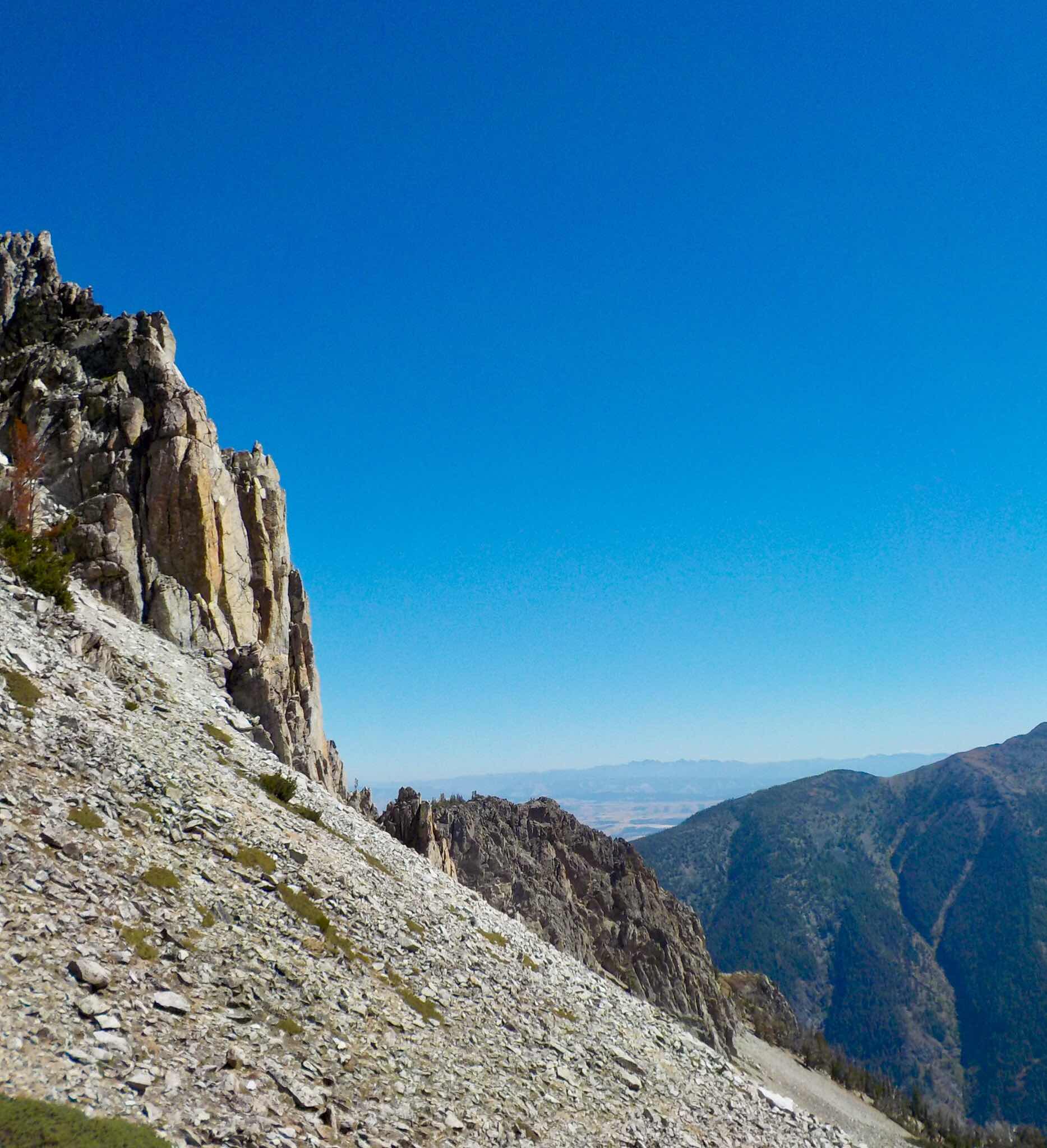
I’m a mostly Coloradoan/New Yorker. I know BIGLY things about what a mountain should look like. To my trained eye, Steens was a series of ridge lines, some attached and horseshoe shaped. Others sitting alone hermit-like (similar to me).

 On the west side, there were scooped out gorges with rivers spouting out of them. The waterways had Santa’s reindeer names: Donner and Blitzen. A few others gave credit to the locals before the White Guys appeared: Big and Little Indian. All that gurgling liquid ends up in America’s Great Basin going nowhere. To the east,  Steens free falls over 4,000’ into the Alvord Desert. 


Its ’s a place designed by a landscape architect high on LSD. Steens is strangely beautiful. 

After a 300 mile drive, I pulled into the hoity toity sounding Steens Mountain Resort. (Three miles past Frenchglen, population 12 or so). It was a well kept and orderly campground. My only complaint was the father and son neighbors who played techno music during daylight hours. (I truly believe techno was invented for people who fear quiet). Blissfully for me, they left in the morning. I decided to stay a second night. 

I took a stroll up nearby Donner and Blitzen River. I left Benedict Arnold the Van (formerly known as Barley the Van) behind at the resort. We needed some downtime. The route wasn’t particularly awe inspiring but it was empty of people. In ten miles of hiking I came across one binocular bearing birder and a retired couple walking their puppy.  It was perfect.


The next morning, I drove uphill. The Steens Mountain Loop Road is deceiving. It’s a mellow grade on a washboard gravelly road to the summit. In twenty miles of so, I ascended over 5,000 feet. The dusty, smoky views were outstanding. All the above mentioned gorges were seen from the topside looking down. There was Wild Horse Lake too. After playing tourist, I plunged down along a ridge line towards South Steens campground. While I was setting up my humble home for the night,  my large nose caught a whiff of Benedict’s overheated brakes. Deceivingly steep. 


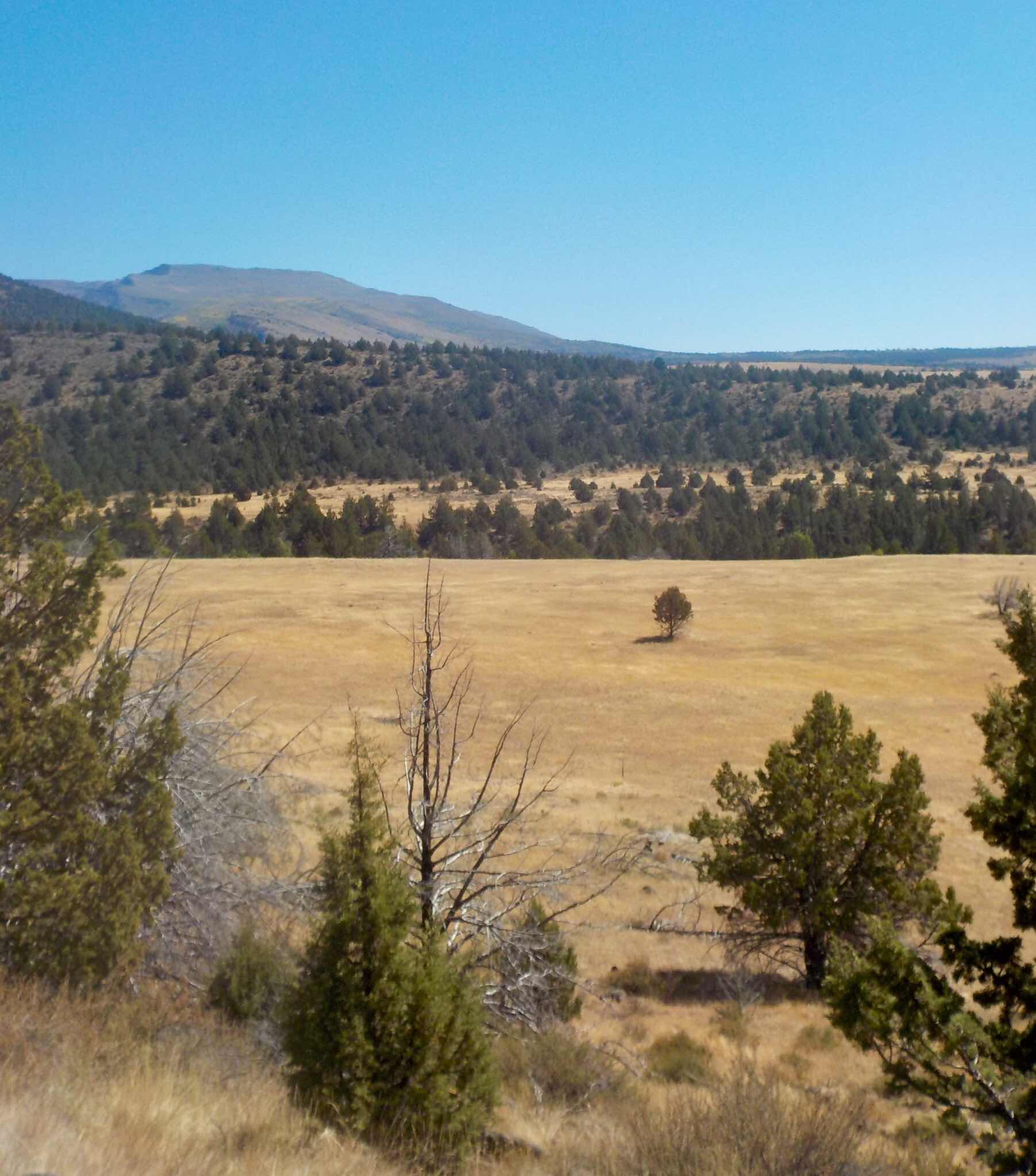
There was an ample supply of sunshine left so I headed off to Big Indian gorge. Once again, the scenery was worth a look-see. Once again I saw less than a handful of humanoids in double digit miles. It was a fine day, topped off in a clean, comfortable and easy of the wallet campsite. The few neighbors I had understood the Three Sacred S’ of car camping. Space, Solitude and Silence.  God Bless Them.


I was up and at ‘em at first light. I wanted to get a hike in before departing Steens Mountain. I decided to go uphill for an overlook of Little Blitzen Gorge. I crossed the river and hit the Fred Riddle trail. Propelled by two pots of coffee and a morning massaging sun, I made good time. I passed a hard working trail crew consisting of young adults wearing hard hats. They were upgrading this slightly used trail to accommodate the “I’d rather ride a horse, than wear trail runners” locals. 


Which brings up a point. Steens Mountain is a “Cooperative Management and Protection Area.” The Bureau of Land Management describes it this way, “ It’s approximately 500,000 acres of private and public land offering diverse scenic and recreation experiences. The CMPA encompasses deep glacier carved gorges, stunning scenery, wilderness, wild and scenic rivers and a way of life for all who live there.” 

Good things happen for all when Public and Private interests decide to play nice.

Steens Mountain is adjacent to Malhuer National Wildlife Refuge. The Wildlife Preserve is infamous as a place where a few misguided miscreants decided to become aggressive hemorrhoids to the Feds.

The High Country Times explains a “Don’t Thread on Me” attitude escalating to gunplay with tragic results. Please take the time to read.


Now I’ll state my own opinion. 

The Hammonds and the Bundy’s and their ilk, deserve to be allowed in one piece of Federal Property-a Penitentiary.

BTW. The Commander in Chaos and Anarchy pardoned the Hammonds who were serving time for arson. I suppose like the Nazi Wannabes in Charlottesville, VA, they too are “Fine People.”

Go see the Steens and thank those cooperating local ranchers who recognized a beautiful place in the Big Picture of things. 

From Yosemite National Park and all is peaceful,

Jeff


Tuesday, September 11, 2018

The Nimíipuu made me do it..

Joseph, Oregon                 

In 2005, it was in this more-than-this-out of the way place where I began bicycling  the Nez Perce National Historic Trail. A journey that took me through Oregon, Idaho, Wyoming and the Nez Perce’s finale in the Bear Paw Mountains of Montana. This Native American history lesson covered 1,900 road miles. Back then, I was a cycling fanatic instead of a hiking, IPA drinking fanatic. (In another era I pedaled over 100,000 miles in a ten year span). 

The Nez Perce story is a sad one. It’s about an inspiring Leader (Chief Joseph), broken treaties, chase scenes, multiple battles, death and capitulation in the low lying wind swept Bear Paw Mountains. In August, 1877, the Nez Perce were captured just short of their Promised Land. Canada. 


To this day, that ride was one of the most interesting and exciting adventures I ever completed. 

Of course, I wrote a story about it. For $3.00 you can purchase the complete work on Kindle. 
Here’s the link: 

https://www.amazon.com/Wandering-Jew-Pursues-Nee-Me-Poo-ebook/dp/B007HQXI86


Joseph, OR is the official National Park Service starting line of the Nez Perce Historic Trail. Thirteen years ago, I took a rest day here to take in all things Nez Perce related and to get a glimpse of the nearby Eagle Cap Wilderness. I ambled up Wallowa Trail wearing uncomfortable bicycle touring shoes. I saw lots of mountains. They were teasing me to take a closer look. I knew I’d return one day. 

I arrived just prior to the long Labor Day weekend. Bad timing on my part. 


I was fortunate to score a campsite in an RV Park owned by a few Stoners. (Not that there’s anything wrong with that, but is it asking too much for them to empty the garbage cans or clean the bathrooms?) I was told I could stay for a few nights, but had to leave on Saturday and Sunday. They were booked up. 

This provided me with an excuse to load my backpack and head uphill. But first, I needed some locals hiking advice. I purchased a Eagle Cap Wilderness map to bring with me to the US Forest Service office. It was a busy place. I wasn’t the only hiker in remote Northeast Oregon. I waited my turn.  


After a smile and a cheery “Good Morning!” I got down to the point, (there was a queue forming behind me), “What area will I find the highest concentration of Alpine scenery?” This wasn’t the first time she heard this question, “Lake Basin. But with the Labor Day Weekend, it’ll be crowded. The Eagle Cap Wilderness has been discovered.” 

Indeed it had been. Early on the Saturday of the Long Weekend, I drove to the end of the Wallowa Road. The official trailhead parking lot was full. I found a pull off on the side of the road  about a quarter mile away. Now my challenge would be scoring a campsite. Off I went at a highly caffeinated clip. My goal was Horseshoe Lake about nine miles away. I passed many hikers with the same idea in mind. 

The first six miles of the hike is in the Wallowa River Canyon. A steep sided place where the summer sun is seldom seen. The hike wasn’t all that interesting among the trees with mere glimpses of the river. At Six Mile Meadow I turned hard right and plunged across the waterway. From that point, I had three miles of uphill along a series gentle switchbacks. As usual, the views improved exponentially. 


When I made Hourglass Lake, I crossed over a logjam to a tiny peninsula. I looked left, right, behind and in front of me. No tents! For two nights, I would occupy (without bad intentions) a Federal piece of lakeside property. Perfect. It was noon. I spent the rest of the day, watching potential squatters hike by and trout rising up for flies. A great start for my weekend. 

I woke to a mirror glass reflection of nearby Hurricane Ridge. After eating a humble breakfast washed down with two Starbucks shots, I packed for the day. My goal was the namesake of the Wilderness: 9,573’ Eagle Cap Peak. A nearly 14 mile round trip hike.


I strolled by a series of Lakes: Lee, Douglas, Moccasin and Mirror. The closer I got to Mirror Lake the higher the concentration of tents and backpackers there were. It was getting on to RV Park packed. That’s a lot of people in a small area. (At Hourglass, I had three neighbors spread out over a half mile. Not bad.) 

The flat summit of Eagle Cap was a small mob scene with a few snarling dogs. I snuck off to a scenic side for a bit of quiet. The Wallowa Mountains aren’t the punk spiky prominences one might find in the Sawtooths of Idaho, or the Wind River Range of Wyoming or the Sierra Nevada’s of California. Most seem rounded and approachable. From my vantage point, they looked user friendly and somewhat bucolic, although getting to them would require plenty of sweat labor. Remember those steep sided glacier created canyons. All in all, I gave the Wilderness two-thumbs up. It’s a beauty. 


Now I’ll attempt to make a point: Eagle Cap Wilderness is not easy to get to. The main trailhead is literally at the end of a long, thin, twisty two lane road. There are no population centers nearby. The closest is Boise (over 2.5 hours away). The furthest is Seattle (more than 5 plus hours away). Yet people come. Many Americans and Passport bearing visitors lust for Wilderness. They will spend time, energy and money in their efforts to visit these special places. This is the BIGLIEST reason why removing acreage from preservation/conservation status (IE: Grand Staircase/Escalante and Bear Ears National Monuments) is short sighted and just plain STUPID. 


This is what I’m learning about Public Land. Create/Protect or Preserve it and People will come. Oh Yes! People will come. Saving Wild Lands for present and future generations is BIGLY smart and the right thing to do. 

Read more about this concept. 


Chief Joseph and the Nimíipuu would approve of this message.

Still waiting for an overpriced new engine for Barley the Van in Chelan, WA.

Jeff